
History of Currarong
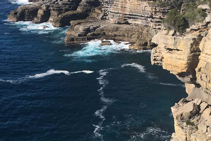
Beecroft Headland Bundarwa
In the late 1830s Alexander Kinghorne and his sons tried to establish grazing and farming on his estate called Mount Jervis. The estate spread from Cabbage Tree on Jervis Bay to Kinghorne Point on the Pacific Ocean. Sailors and fishermen often sheltered in the safe haven of Abraham’s Bosom.
The first land grant at Currarong was 34 acres in 1858 to Helen Jane Mackay, daughter of the first Crown Lands commissioner in Nowra. It covered approximately the area between Walton Way, Piscator Avenue, Fishery Road and Merimbula Street. This was bought by Henry F Halloran in1928 and became the Halloran Subdivision in 1930.
From the 1880s part of Beecroft Peninsula has been used by the Royal Australian Navy for bombing and offshore to onshore target practice. In 1955 shells from the Black Prince, a New Zealand ship doing exercises with the RAN, came a little too close, landing in the village and off Currarong Creek. The area is now known as the Beecroft Weapons Range.
In 1898 because of the many shipwrecks and the wrongly placed Cape St Georges Lighthouse, Point Perpendicular Lighthouse was built.
Fishing and Camping
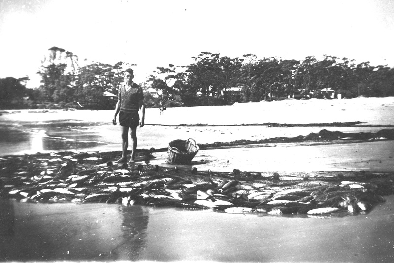
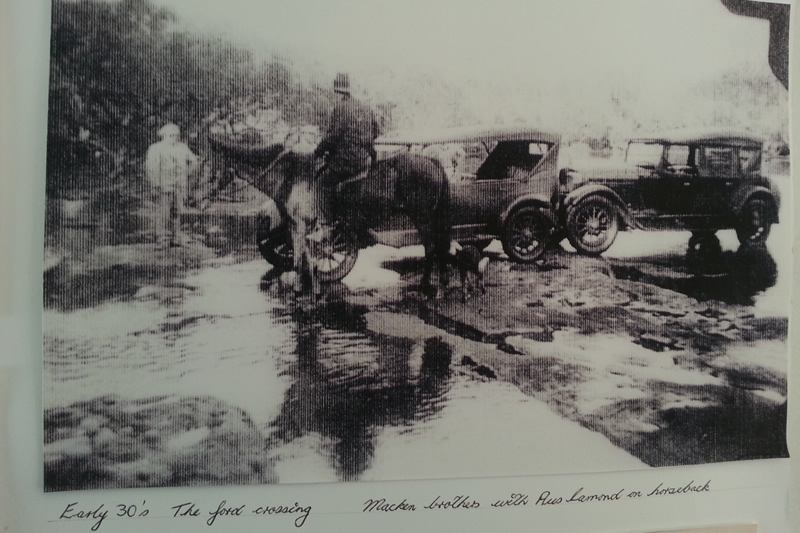
A little later the Hammer brothers built a shack and started commercial fishing from Currarong taking their catches up the Shoalhaven River to Bomaderry railway station and on to Sydney. Currarong slowly became known as a magnificent fishing and camping spot for people from Sydney, Wollongong and the Shoalhaven area. They came in boats from Greenwell Point or overland by horse and cart on dirt roads and along the beach. They stayed in makeshift tents and huts. They roamed the headland enjoying places like Drum and Drumsticks and Cabbage Tree. They left with huge catches of fish and amazing stories about Currarong and Abraham’s Bosom Beach.
Some Shipwrecks
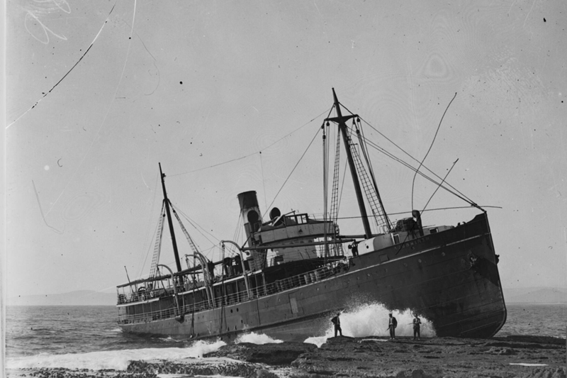
In 1928 the wreck of the Merimbula on Whale Point created a long-term tourist attraction and brought more visitors to Currarong as well as lots of salvaged building materials and tinned food supplies. Bill Lennox was appointed caretaker of the wreck.
Currarong Village
Improvements
Currarong’s reputation as a magnificent fishing, camping and holiday destination continued to grow. The village acquired more services- electricity, picture theatre, tennis courts, septic tanks, sealed roads, town water, more shops and finally sewerage. The Fire Shed on Walton Way was replaced by the Fire Station on Fishery Road and became the Arts and Crafts Workshop. The Club was extended and the Progress Hall refurbished. The road through the Caravan Park was diverted. Beach Mission was held during the Christmas holidays.
1965
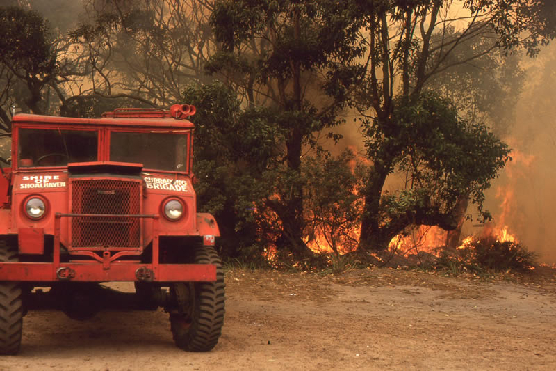
Bushfires burned 13 houses and buildings and much of the bushland.
1988
The Abraham’s Bosom Walking tracks were redeveloped.
1998
Currarong became part of the Jervis Bay Marine Park.
1999
Currarong Seafarers Festival celebrated the centennary of Point Perpendicular Lighthouse.
2001
New bridge over Currarong Creek.
2009-2010
Currarong connected to the sewer. Renovating and rebuilding boom started.
2011
New boat ramp built.
2014
Shops redeveloped as Zac’s General Store and Café.
2015, 2016 and 2017
Bushfires burnt out much of Beecroft Peninsula.
2016
An East Coast low with high winds and huge waves damaged all the dunes on Bosom and Warrain Beaches and threatened waterside homes.
2018
Third successful Currarong Easter Art Show. New Community Shed at the Club.